Aerial mapping for various industries
At Aerovision Drones, we offer professional drone services that transform the way projects are visualized and managed across a variety of industries.
Photogrammetry
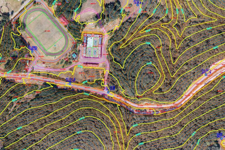
Photogrammetry is essential for transforming your projects with accurate and reliable data. Using state-of-the-art drones, we generate 3D models and detailed maps that optimize processes in sectors such as construction, agriculture, and urban planning. Our service ensures accurate and efficient results, giving you a complete view of the terrain without the need for costly travel.
Our photogrammetry-based methodology, a key component of our drone services, captures high-precision aerial images.
Enabling the creation of detailed maps and three-dimensional models of topography, land structures, and infrastructure.
La 3D Digitization, generates detailed models for land management.
This result provides a complete and accurate view for planning, analysis, and decision-making in your projects.
More services with drones
-
Topographic profiles
Photogrammetry Topographic Profiles Topographic profiles are detailed representations of the terrain's relief along a defined line. Traditionally, they were obtained using tools such as theodolites or handheld GPS, but the use of drones in surveying has revolutionized the way terrain data is captured and analyzed. Drones…
Ready to get started? Contact us today and find out how we can help you take your projects to the next level.